Need a natural health kick?
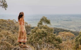
Since the late 1800s people have visited the Daylesford and Macedon Ranges region for the rejuvenating effects of its cool climate and natural beauty. Those same health benefits remain today – they’re just a lot easier to enjoy thanks to a bunch of energising walks.
Here are a few of our favourites:
Domino Trail, Trentham & Lyonville, 12km / 3 hours
The Domino Rail Trail is an easy 12km return walk (approx. 3 hours) following the old railway line from the heritage listed Trentham Railway Station (no longer in use) into the Wombat State Forest, finishing in Lyonville next to the Radio Springs Hotel. The trail mostly runs along the rail alignment between Trentham and Lyonville, which was once part of the original railway from Daylesford to Carlsruhe. It is a smooth, wide, all-weather trail suitable for walkers, cyclists and horse riders, it is also pet friendly (pets must be on a lead).
Start your journey at either end of the trail. In Lyonville, return to the Radio Springs Hotel for a refreshing drink and a bite to eat. In Trentham, return to food spots such The Cosmopolitan Hotel or Hotel Trentham, both an easy walk from the station.
Hanging Rock Reserve, Woodend, 1.8km / 50-minutes
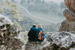
The Hanging Rock Summit Walk is a moderately challenging trail, which takes about an hour to complete, making it accessible for most fitness levels. The walk begins at the base of the rock formation, winding through dense eucalyptus forests and offering glimpses of the surrounding countryside. As hikers ascend, the path becomes steeper, but the effort is rewarded with breathtaking panoramic views from the summit.
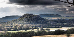
At the top, the jagged rock formations create a dramatic landscape, famously featured in the novel and film Picnic at Hanging Rock. The summit provides seemingly endless vistas of the surrounding plains, forests, and distant mountains and extinct volcanoes. The Hanging Rock Summit Walk is not just a physical journey but also an immersive experience in nature, offering a sense of tranquility and a connection to the natural beauty of the region.
Murmuring Walk, Mount Macedon, 1.6km / allow 1 hour
The Murmuring Walk at Sanatorium Lake offers an immersive audio-guided experience that beautifully captures the serene environment, diverse birdlife, and natural rhythms of Sanatorium Lake, nestled at the summit of Mount Macedon. As you embark on this tranquil journey, simply connect your headphones to your personal device and step into a contemplative space, guided by a sublime, multi-layered soundtrack of vocals and poetry. This self-paced walk is entirely free and available to enjoy at any time.
Download the audio guide here: Murmuring Walk at Sanatorium Lake.

Conglomerate Gully Walk, Riddells Creek, 2.9km / 1 hour
Riddells Creek‘s best kept secret, Conglomerate Gully is a magnificent rocky gorge, estimated to be about 400 million years old. The walk takes you through one of Victoria’s most pristine natural landscapes. This 2.9km circuit trail showcases diverse eucalyptus forests, where you’ll encounter striking rock formations, lush fern gullies, and an abundance of native wildlife and wildflowers. The walk is named after the unique conglomerate rock found along the path, a fascinating geological feature that tells the story of the area’s ancient volcanic history.
Ideal for most abilities, the trail is well-marked and provides several scenic lookouts with breathtaking views of the surrounding ranges. Along the way, interpretative signs offer insights into the region’s flora, fauna, and cultural significance. Whether you’re looking for a peaceful escape or an adventurous day out, the Conglomerate Gully Walk promises a memorable experience, only 45 minutes from central Melbourne.
La Gerche Forest Walk, Creswick, 2.2km / 1 hour
The La Gerche Forest Walk is a serene 2.2km self-guided loop that winds through the historic nursery plantations near the former Creswick Landcare Centre. This trail honors John La Gerche, Creswick’s pioneering forest bailiff, whose dedication to forestry shaped the landscape you see today. The towering trees, planted by La Gerche himself, stand as living testaments to his vision, now over a century old.
As you stroll, you’ll encounter informative storyboards that delve into the history of the area, particularly the profound impact of mining on the forest. They also showcase La Gerche’s remarkable efforts to rehabilitate the land, including his innovative experiments with various eucalypts, pines, and other introduced species. The result is a captivating and picturesque diversity of trees that offers both beauty and a glimpse into the past.
For more information, visit Parks Victoria.
Black Hill Reserve, Kyneton, 3.9km / 1 hour
Discover the untamed beauty of Black Hill Reserve, a captivating blend of natural and restored bushland that showcases breathtaking wildflowers, abundant local wildlife, and awe-inspiring granite rock formations. Among these, ‘The Monolith’ stands out as one of Victoria’s most impressive granite features. Just a ten-minute drive from Kyneton, this natural haven offers a perfect escape for rock climbing, picnicking, and bushwalking, with a variety of tracks to suit all fitness levels. While you explore, feel free to bring your furry friends, but remember they must be kept on a leash at all times.
Embark on the gentle 3.9 km Circuit Track that meanders through the reserve, with only a few inclines to navigate. Midway through your journey, you’ll find picnic tables nestled beneath the towering Monolith rock in the north-east corner, offering a picturesque spot to pause and soak in the scenery. Allow at least an hour for this walk.
In spring, the south-east section of the track comes alive with vibrant wildflowers and orchids. Keep an eye out for kangaroos grazing in the nearby paddocks, echidnas foraging for ants, and the occasional wallaby venturing down from the higher parts of the reserve. Find a comfortable rock or fallen tree to sit on, and immerse yourself in the chorus of birdsong from the many avian species that call this serene landscape home.

Macedon Ranges Walk, Macedon, 18.8km / 5 hours
For something a little more challenging, Macedon Ranges Walk is a popular trail that offers many opportunities to explore Macedon Regional Park via a series of tracks, covering a total distance of 18.8km. The trail departs from and returns to Macedon Train Station (meaning you can easily arrive by train, directly from Melbourne if you wish to do this walk).
Most sections of the trail are Grade 3 level moderate to difficult walking due to the steep mountain slopes. Trail users can enjoy shorter sections or as a complete loop, notable attractions such as the Mount Macedon Memorial Cross, Camels Hump and Sanatorium Lake. The trail also passes through a number of picnic grounds, some with toilet facilities.
Visitor tips: Check the weather forecast before exploring the park as Mount Macedon is usually cooler than surrounding areas and conditions can change quickly. Please bring adequate drinking water with you. Hiking poles may be useful for steeper ascents and descents.
https://www.parks.vic.gov.au/places-to-see/sites/macedon-ranges-walk
Tipperary Springs/ Twin Bridges, Hepburn Regional Park, 4.6km, 1.5 hours
Step back in time as you track a gold rush era water race and wind through a forest gully lined with smooth white-barked eucalyptus. Get started at Tipperary Springs picnic area just outside Daylesford within Hepburn Regional Park. Cross a footbridge over Sailors Creek then follow the signs to Twin Bridges. After passing rocky outcrops and crossing small gullies, you’ll need a little balance as you hop-skip-and-jump across a creek on stepping stones. Up a hillside, down some steps, and then back along the creek towards where you started it all, at Tipperary Springs.
https://www.parks.vic.gov.au/places-to-see/sites/tipperary-springs-day-visitor-area
Mt Franklin Summit Walk, Mt Franklin, 2km / 1 hour
With its tall forested crown, Mt Franklin, known as Lalgambook by the Dja Dja Wurrung Traditional Owners, sits proudly on the land just north of Hepburn Springs. The visual drama of this extinct volcano continues in its belly – a deeply shaded crater of elm, poplar and sycamore trees that’s popular for campers. Heading off from here you’ll wind up through the foliage, past pockets of tufted grasses and manna gums, before reaching the summit, and a fire lookout tower. Though you can’t climb this one, stunning views south-west towards Shepherds Flat require no further elevation.
Sailors Falls Loop, Sailors Falls, 1.4km / 40 min
At Sailors Falls, on the outskirts of Daylesford, you can drink mineral springs from a hand-pump, before descending into a deeply incised valley on a recently built steel and stonework staircase. With bubbling Sailors Falls as your backdrop, work your way through a secluded pocket of the wet forest before zig-zagging through tall manna gums and stringy bark trees. After following the path of an old water race from the gold mining days, you’ll soon reach the lower mineral springs on the bank of Sailors Creek. Continue to the staircase and up to where you started, where a shaded picnic area and mural shelters offer a place to catch your breath.
Walk notes:
Check the weather forecast and bush fire warnings before undertaking any walks or hikes.
For the most up to date conditions visit parks.vic.gov.au or call 13 19 63.
About the author

Daylesford Macedon Tourism
Daylesford Macedon Tourism Ltd is the Regional Tourism Board for the Daylesford and Macedon Ranges region.
- Daylesford Macedon Tourismhttps://daylesfordmacedonlife.com.au/author/daylesford-macedon-tourism/April 21, 2018
- Daylesford Macedon Tourismhttps://daylesfordmacedonlife.com.au/author/daylesford-macedon-tourism/April 21, 2018
- Daylesford Macedon Tourismhttps://daylesfordmacedonlife.com.au/author/daylesford-macedon-tourism/April 21, 2018
Share this article
While You're Here
Food from Local Woods, Meadows, Farms & Gardens
Good food, together with good sleep, prioritising exercise (even if it’s just a ramble through our…
Unique Wellness Therapies
The ancient Geisha Facial treatment, utilising powdered nightingale droppings to ensure a radiant,…
The Inside Word with Jodi Flockhart
Our region celebrates the change of season to autumn with a stunning array of golden leaves, and…
Encounters of the Spooky Kind
It is said that Victoria’s historic goldfields are some of the most haunted places on Earth.…
Gut Health
In a strange and circuitous way my life has led me to thinking daily about an old adage: ‘go with…
Top 10 Things To Do When You Next Visit
We asked, and you voted. Here are the top 10 things to do in our region. It’s a great mix of…
Health & Wellness,Eat & Drink,History & Culture,Outdoor Experiences


