

Trentham Falls
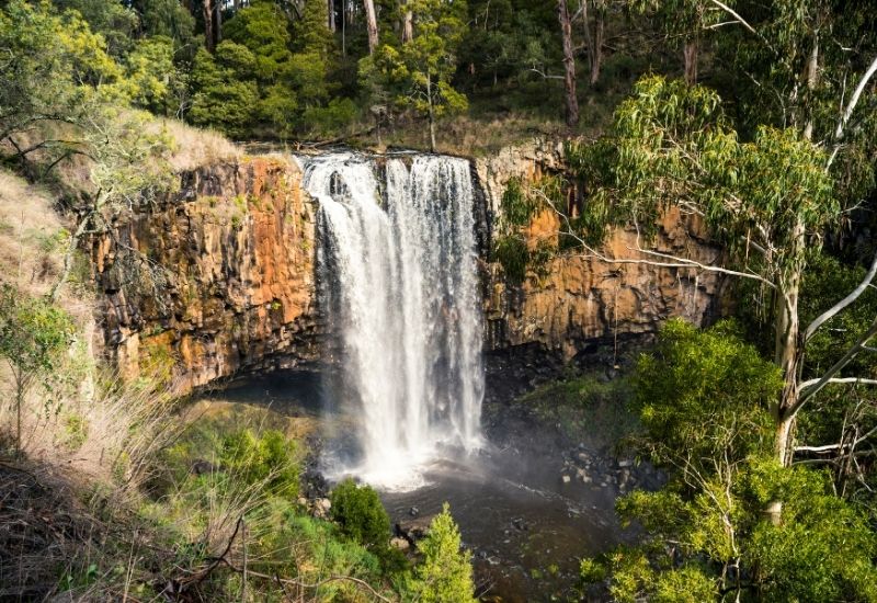
Trentham Falls is one of the longest single drop waterfalls in Victoria, with its waters cascading 32 meters. It is an easy walk to the Trentham Falls viewing area from the parking and picnic area. Lush bushlands surround the falls, and the area boasts impressive hiking and bike bush tracks.
CLICK HERE FOR DIRECTIONS
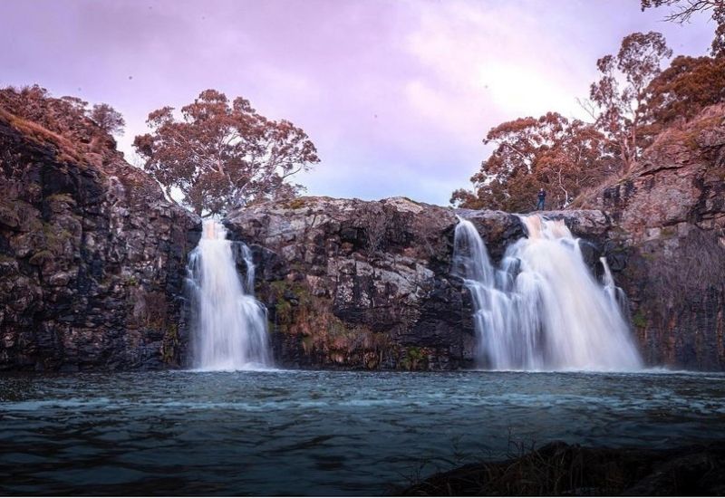 Turpins Falls is an impressive waterfall located on the Campaspe River, and its waters cascade down a 20m rock wall that encapsulates the rock pool below on three sides. You can enjoy the beauty of the falls from a lookout just a short walk from the car park, or you can access the base of the falls via a steep unmaintained track. This track is subject to seasonal closures, usually during autumn and winter. **
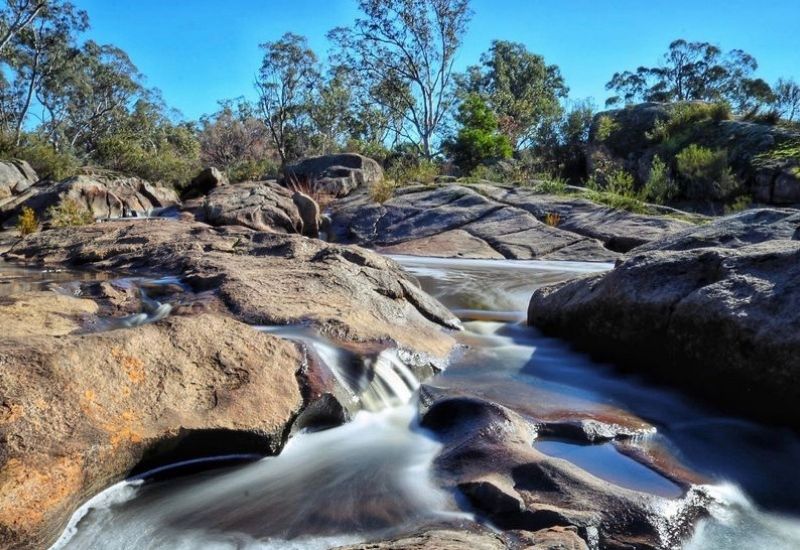 The Cascades is a hidden gem nestled away just north of Metcalfe. Water tumbles over layers of bedrock through rock pools, through crevices and funnels into little caverns. Relax in the rock pools or take a swim in one of the bigger swimming holes. It is best to visit after some rain. Photo Credit:
 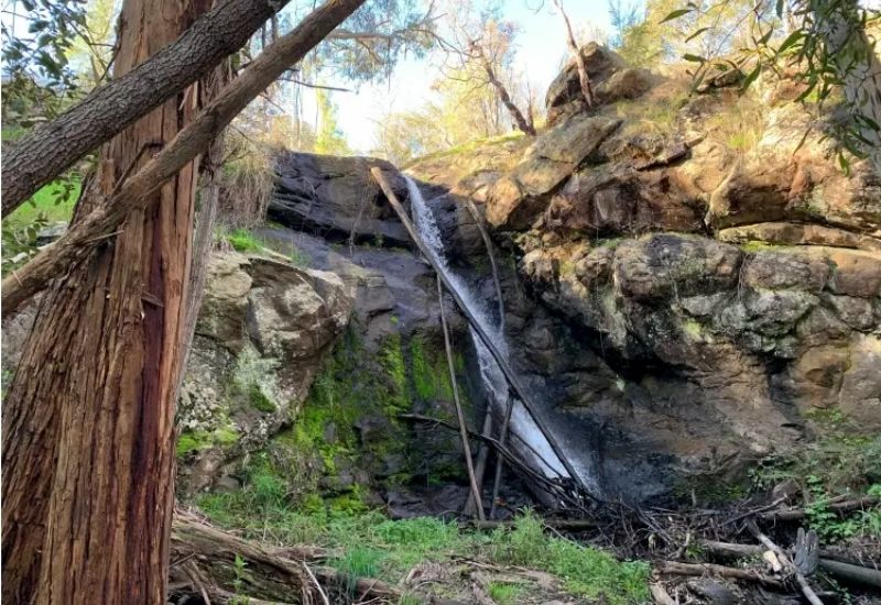 Stanley Park Falls was named after Sir Arthur Stanley, Governor of Victoria. He was instrumental in providing funding to acquire the land for public use. The area is thought to have formed from silica-rich lave, which probably originated from ‘Camels Hump’ and flowed down the flank of Mount Macedon. Nowadays, it is a lovely waterfall and a lush refuge in summer with playgrounds, BBQ's and picnic benches. Photo Credit:
 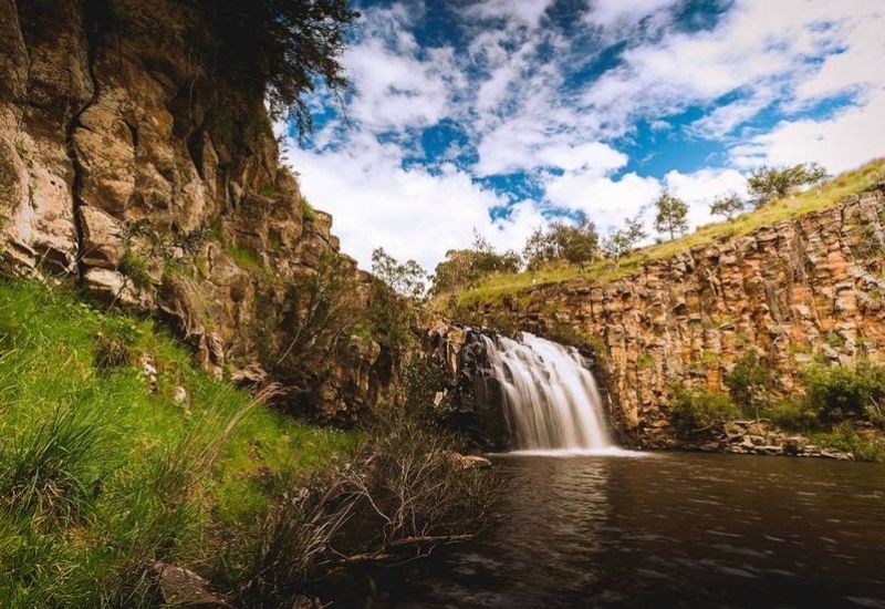 Loddon Falls is found a short 5-minute drive north of Glenlyon, along the Loddon River. This is an undeveloped spot with a steep incline and dirt tracks that can get muddy in the wetter months. It has restricted access when there has been significant rainfall. If you are keen to forge on, you will be rewarded with spectacular views of the waterfall and surrounds. Photo Credit:
 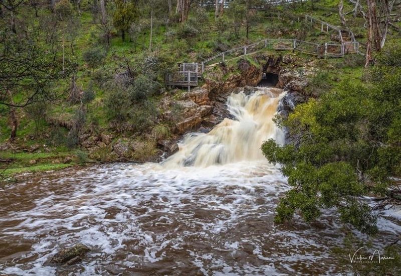 Gold miners created this small circular hole in the side of the hill around the early 1870s. When Sailors Creek is full, The Blowhole is an impressive sight, spurting water out over a rock face to the pool below. You can view The Blowhole from above at the cliff's top, making the most of the recently installed walkway, or across the river, standing opposite the tunnel. The Blowhole is one of many places to stop along the 160km Goldfields Track connecting Bendigo and Ballarat. Photo Credit:
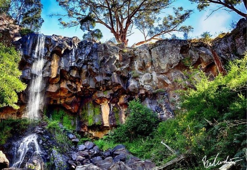
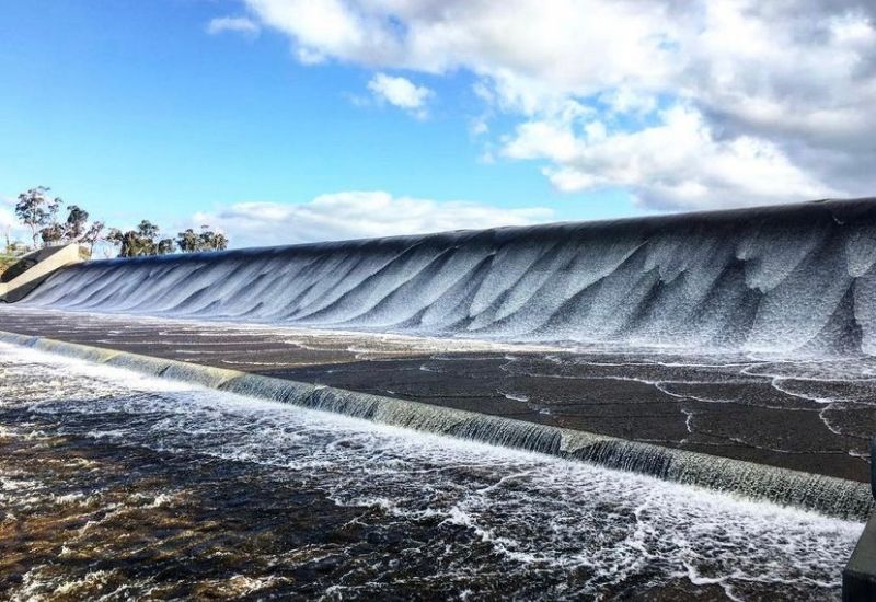 The Upper Coliban Reservoir spillway is the only siphonic spillway of its kind in Victoria. It's an impressive structure and looks incredible after heavy rain, with water gushing over the dam. You can see the spillway clearly from the road beneath, or you can stop at the picnic ground with BBQ facilities and toilets. It is a popular spot for fishing, with the reservoir regularly stocked with brown trout, Murray cod and golden perch yearlings. Photo Credit:
 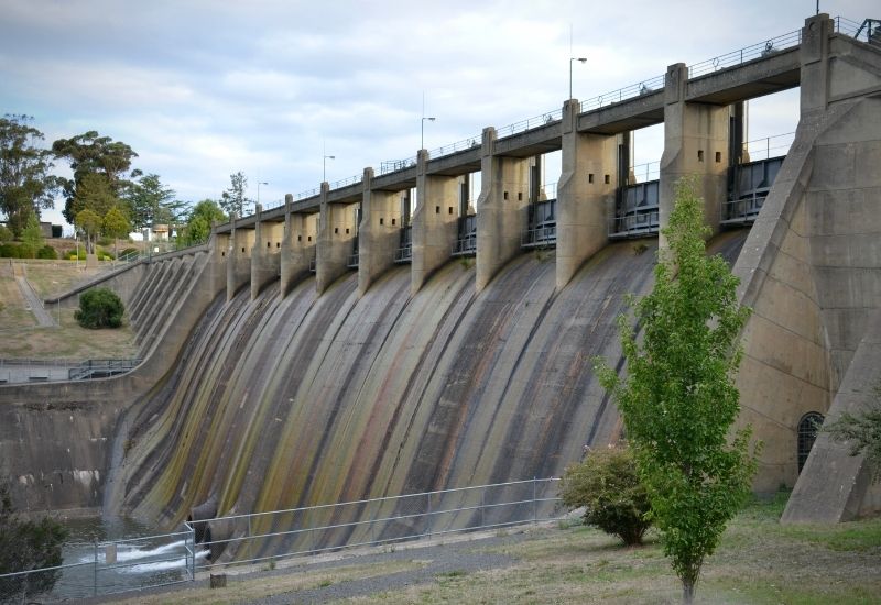 The Upper Coliban Reservoir feeds into the connecting Lauriston Reservoir found between Kyneton and Glenlyon. The Lauriston Reservoir dam was constructed between 1938 and 1941 and has a spillway that measures 77 metres. It's a well maintained reserve with walking trails, BBQ's, picnic tables, playground and toilets. In 2019 the reservoir welcomed kayaks and non-powered boats to enable fishing of the abundant native fish.